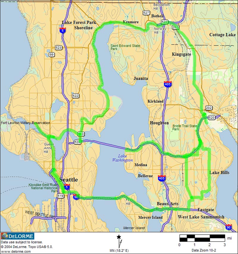
Bicycle Commuting

I've been interested in mapping out bicycle commuting routes in Seattle for a couple of years. I did an earlier web site covering the bicycle route from downtown Seattle to the Overlake area of Redmond via I-90. This site used Microsoft MapPoint software for the base maps. Last summer (2003) I collected some GPS data for this and other routes to the east side. I wanted to use this data to expand my web site, and although I like MapPoint, I began to run into some limitations in its support for drawing custom objects on the maps. I recently tried out Topo USA 5.0 from DeLorme. I found its drawing support superior to MapPoint, and I like the topographic contours, which MapPoint lacks. I wish DeLorme had an object model for Topo USA. This is a significant advantage with MapPoint, but since I haven't needed this yet, I'm finding Topo USA well suited to my current needs.

So far I've mapped out three routes from the Fremont neighborhood (where I live) to the Overlake area of Redmond (where I work). In the future I plan to add some loops through Capitol Hill, downtown Seattle, Ballard, and the University district, as well as some routes out of town. To explore a route, just click on the map near the route you're interested in. Alternatively, you can use the navigation bars.

Home Burke Gilman Route 520 Route via Bus I-90 Route

Fremont to Overlake via Burke Gilman and Sammamish River Trails Montlake to Overlake via Bus and and SR 520 Trail Fremont to Overlake via I-90 Trail

Home Burke Gilman Route 520 Route via Bus I-90 Route